
|
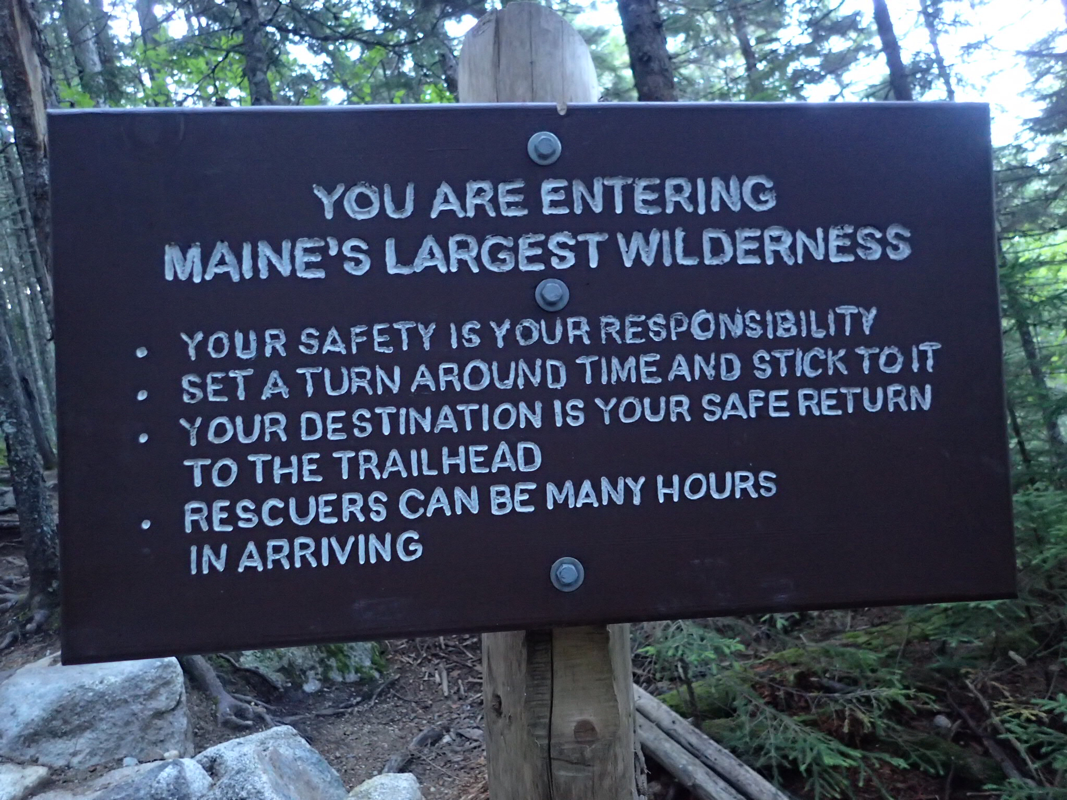
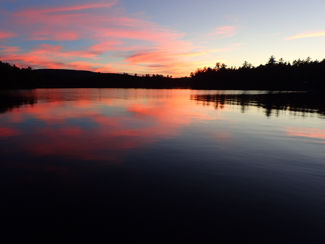
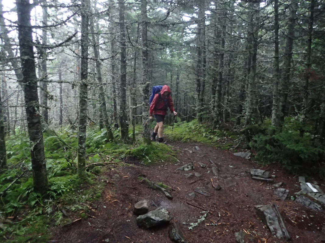
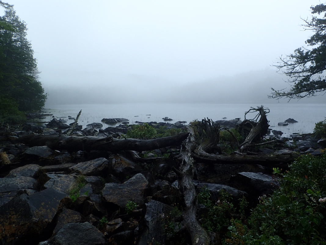
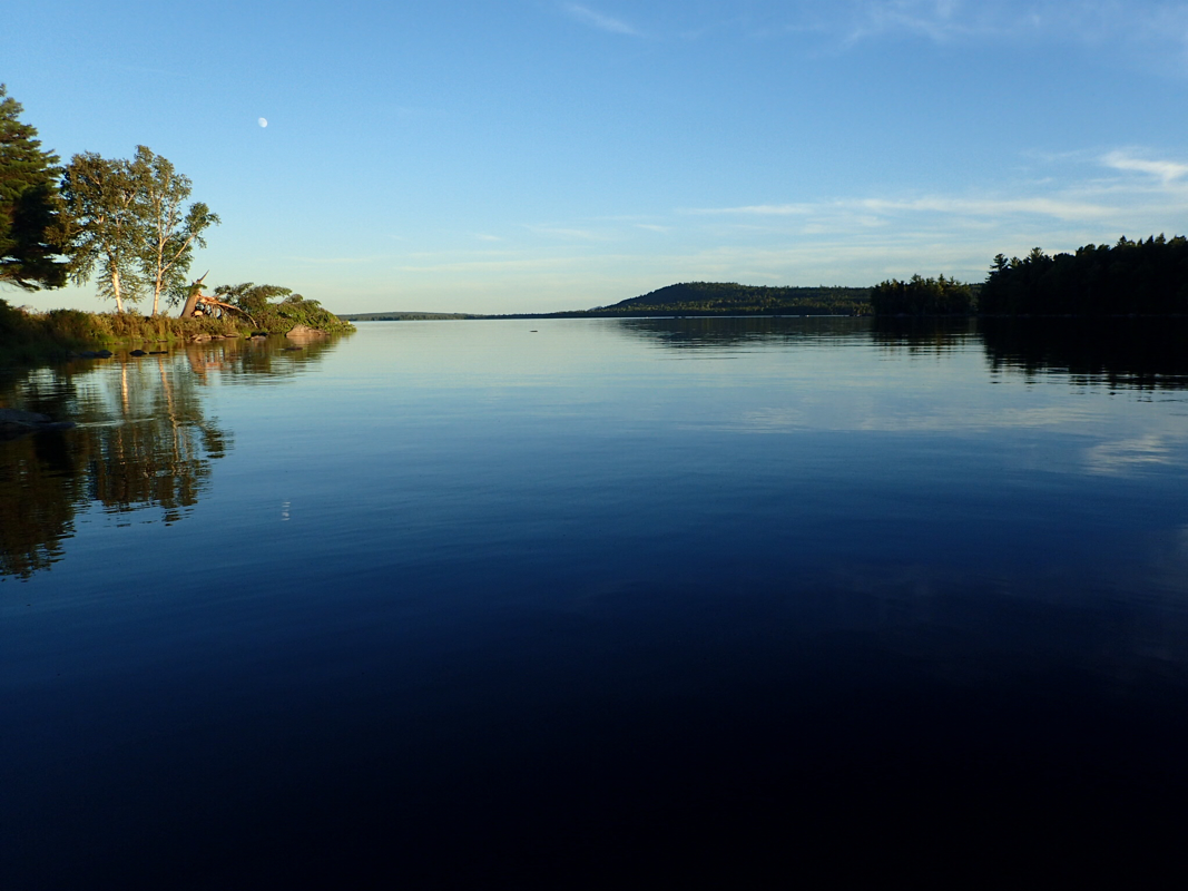
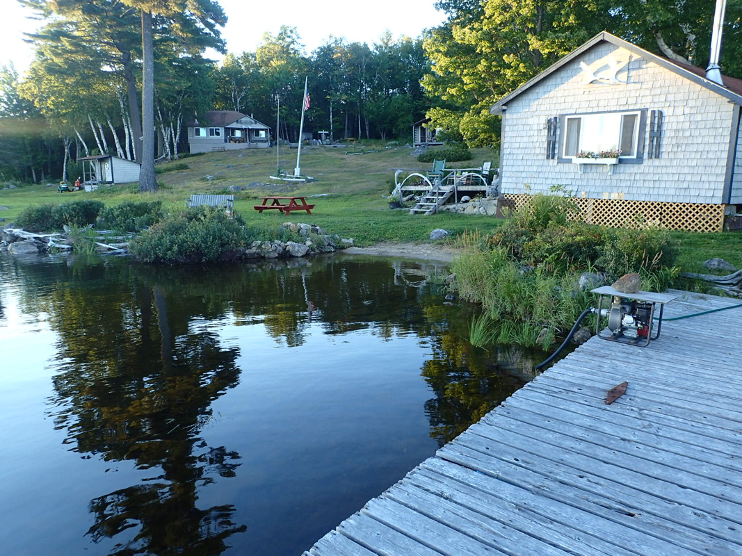
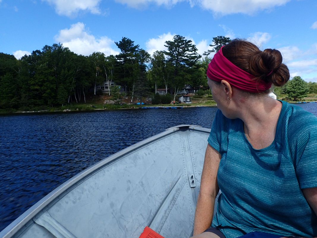
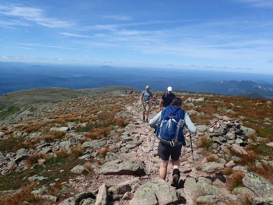
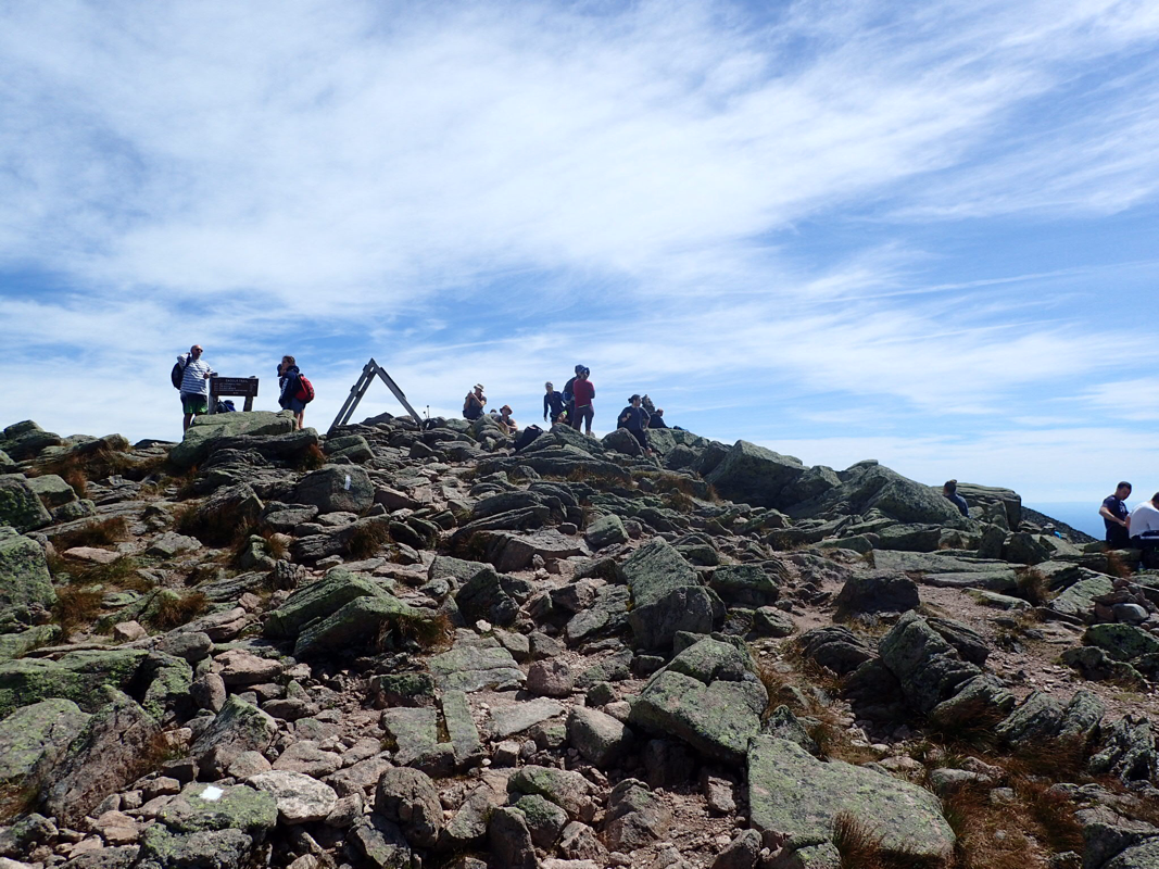
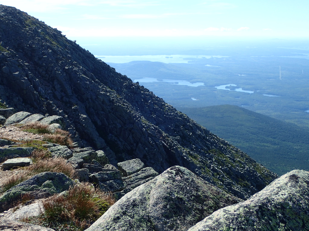
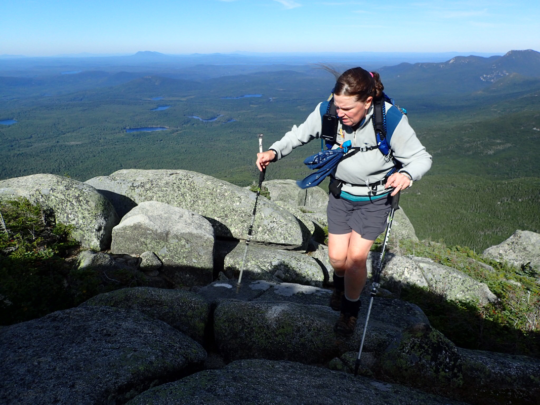
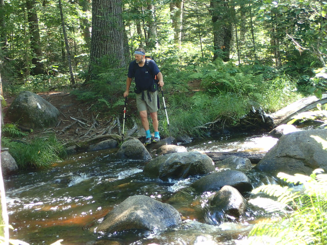
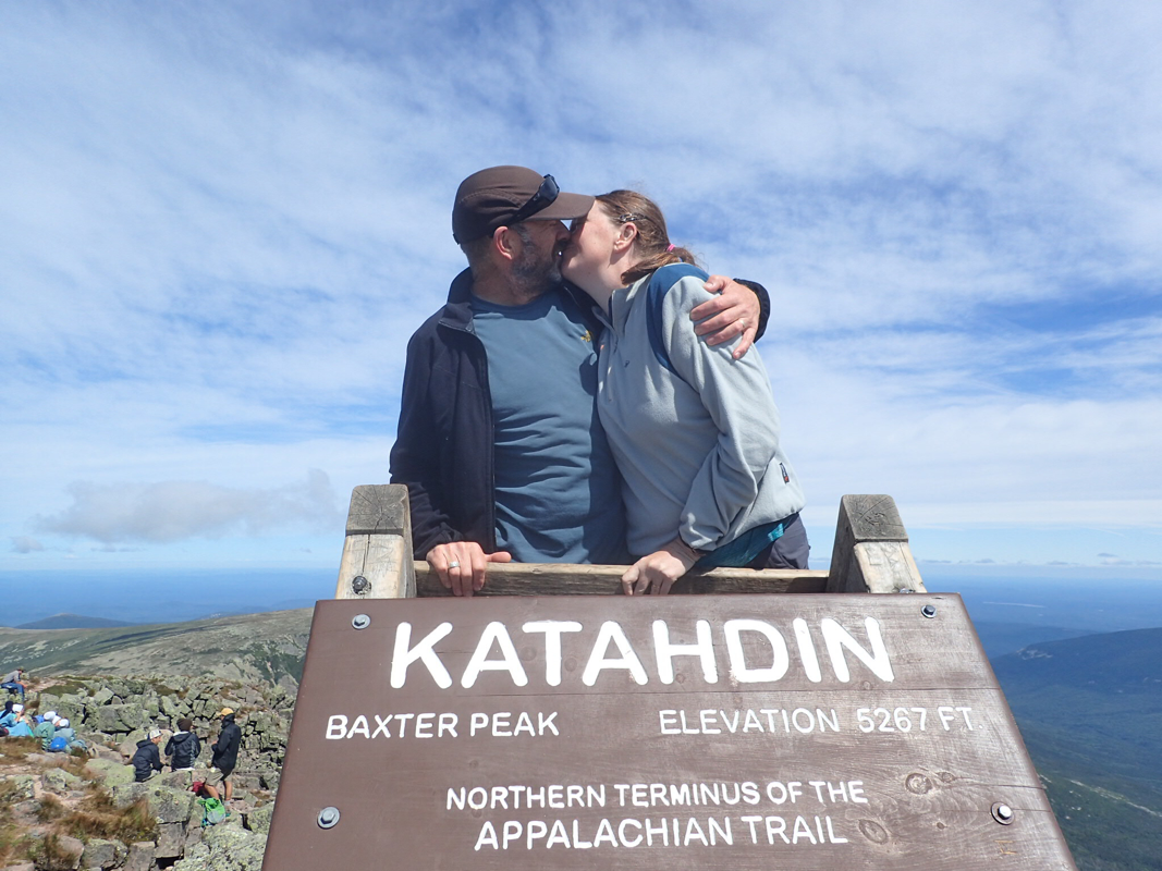
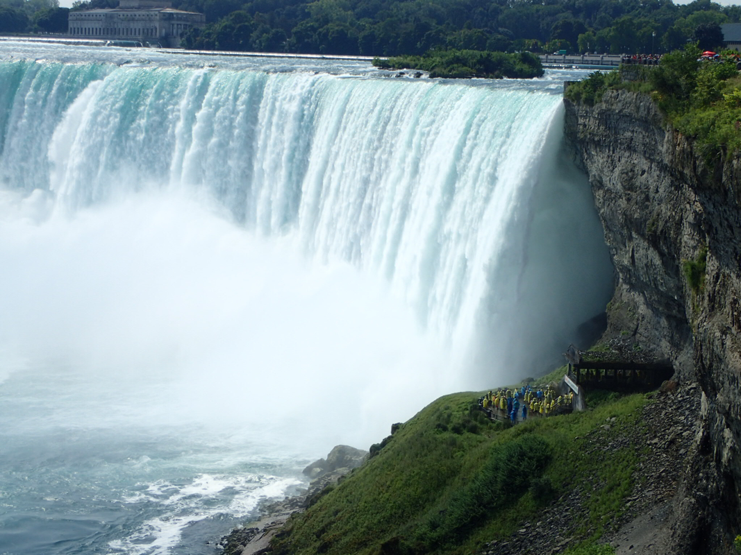
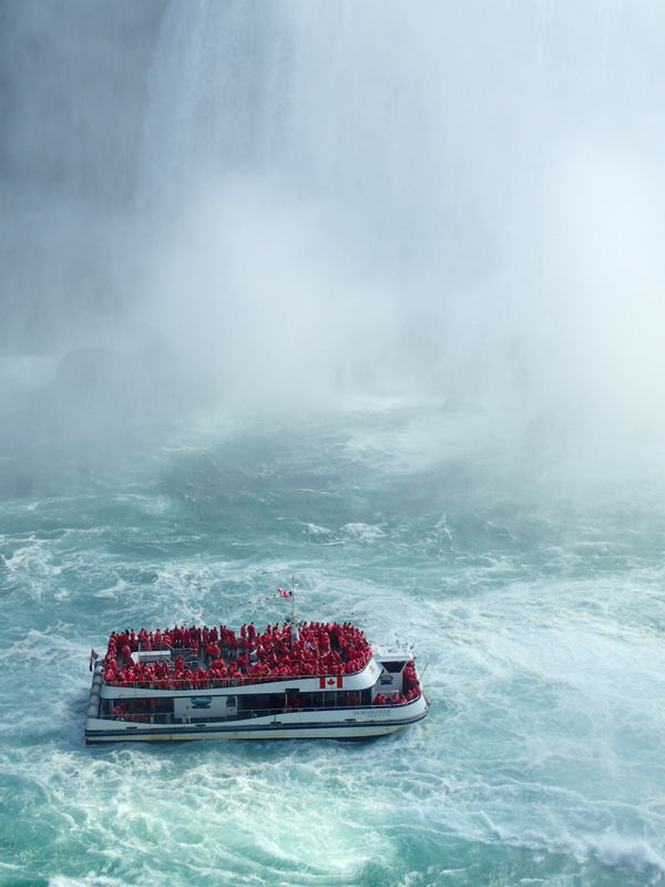
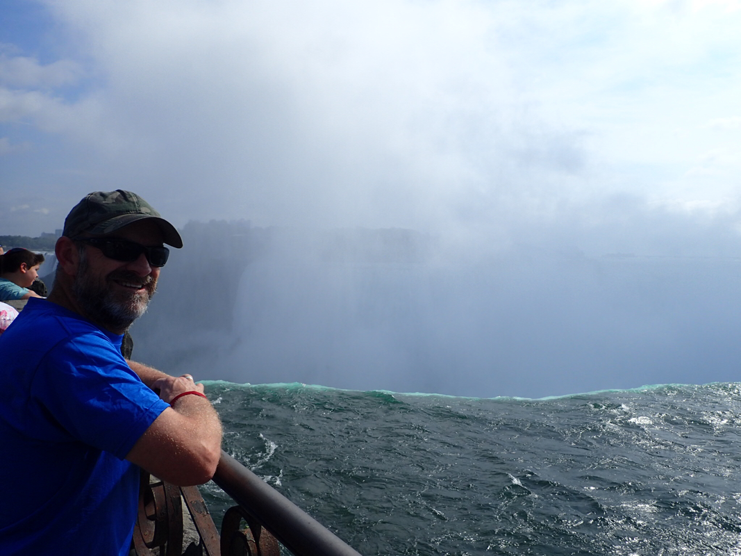
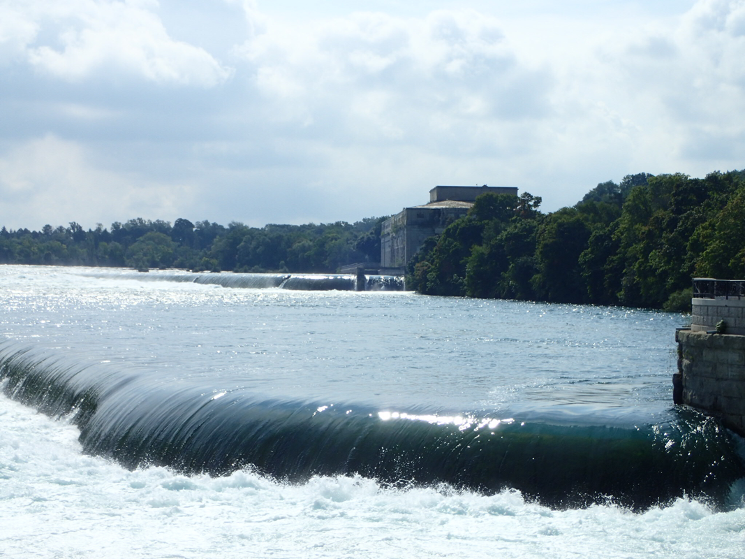
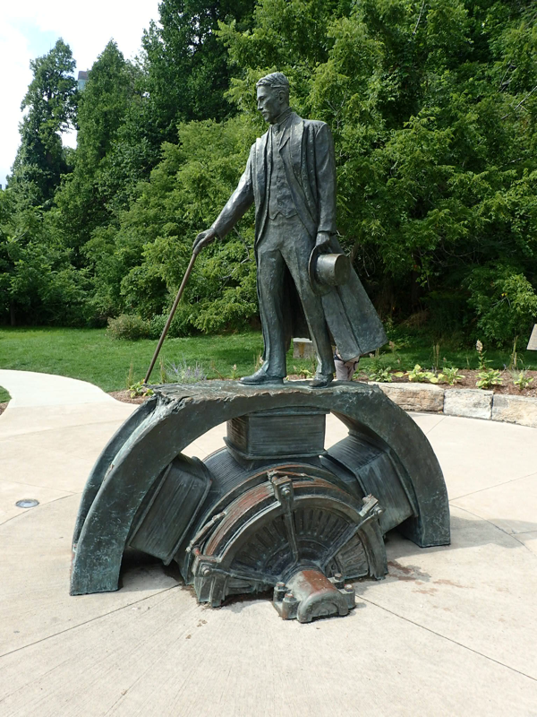
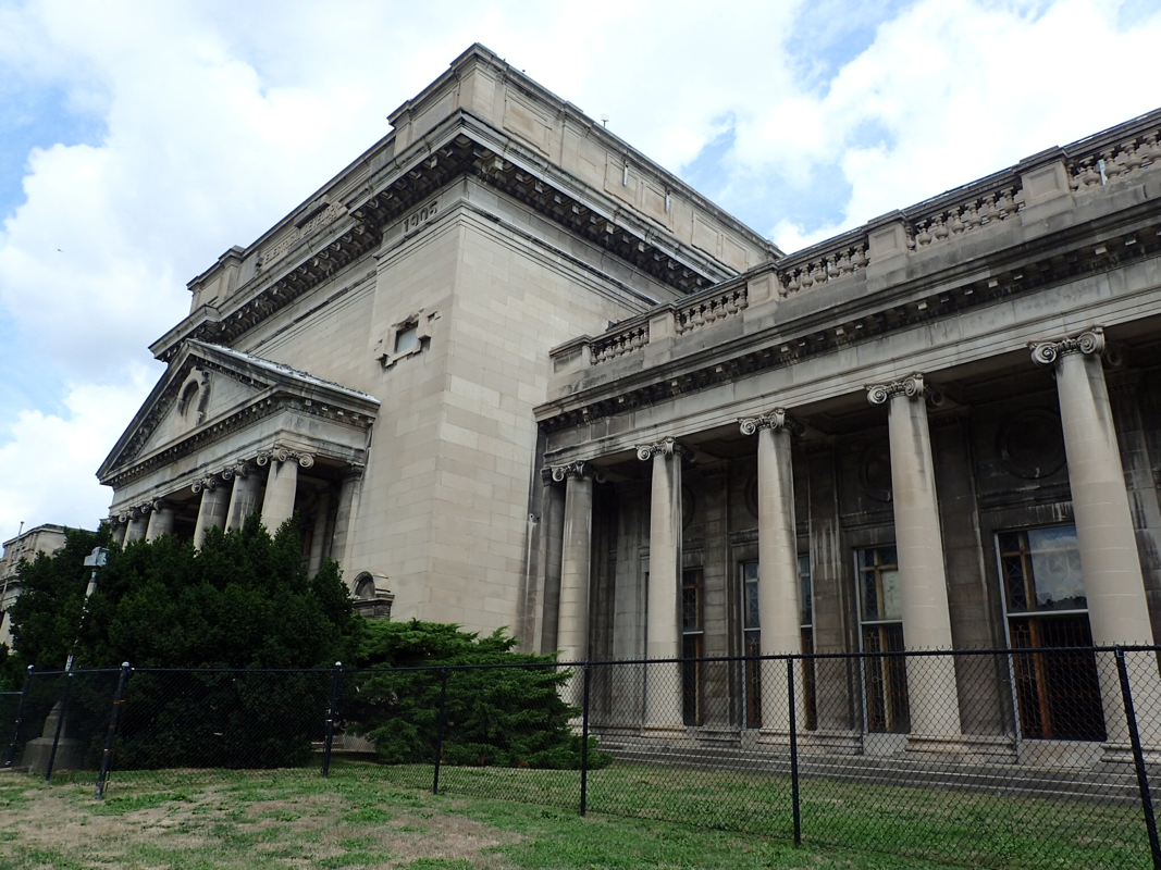
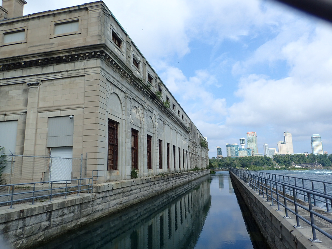
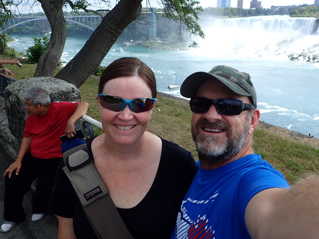
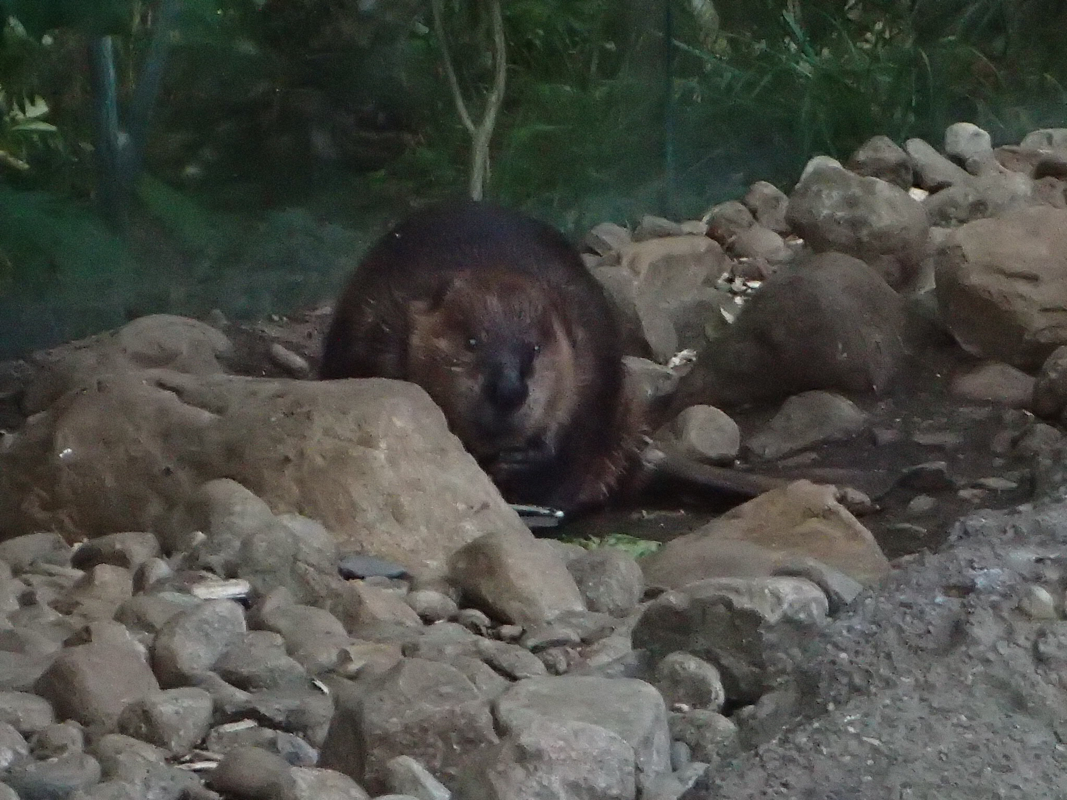
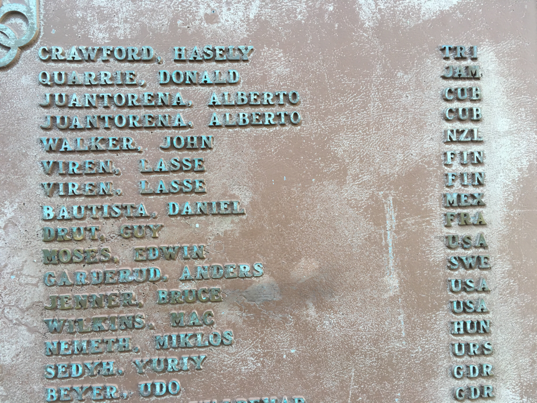
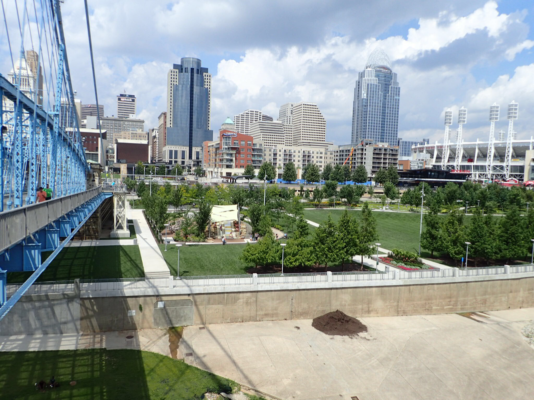
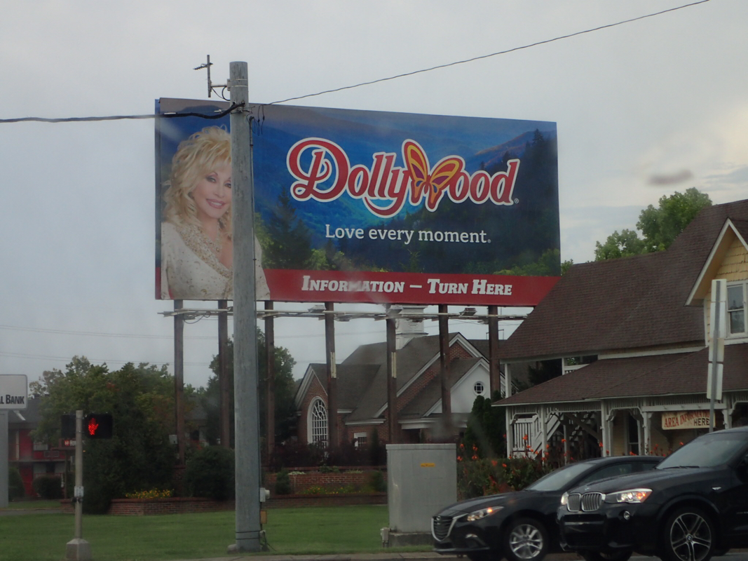
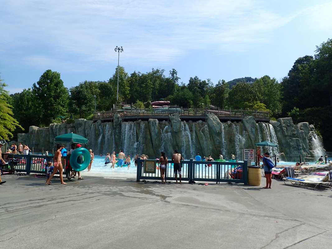
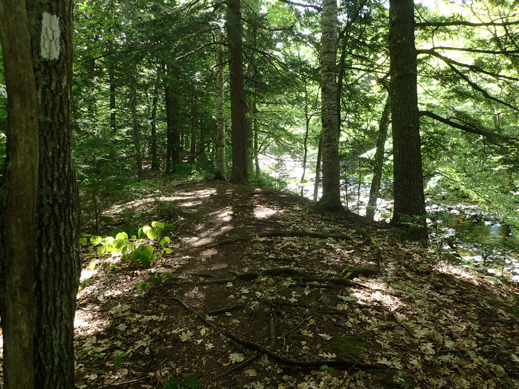
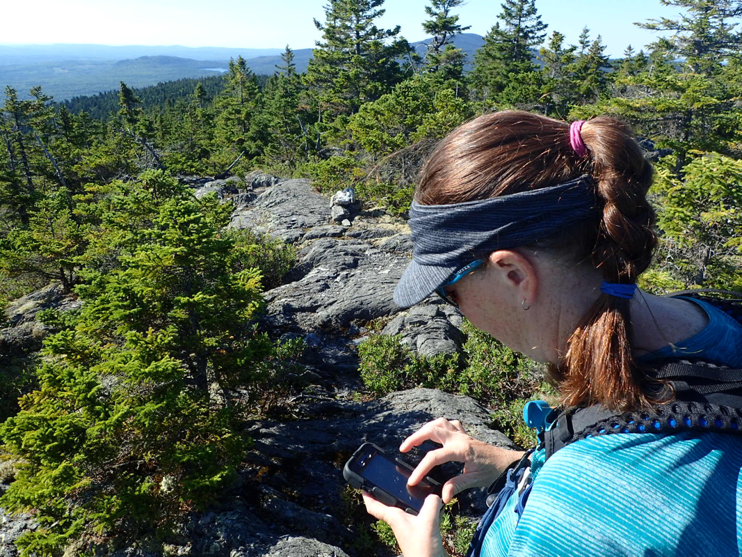
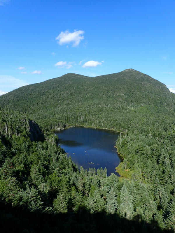
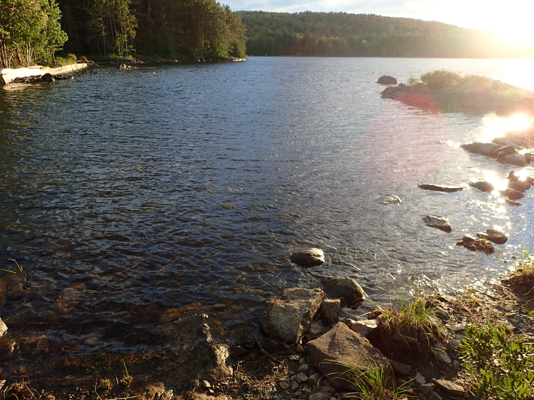
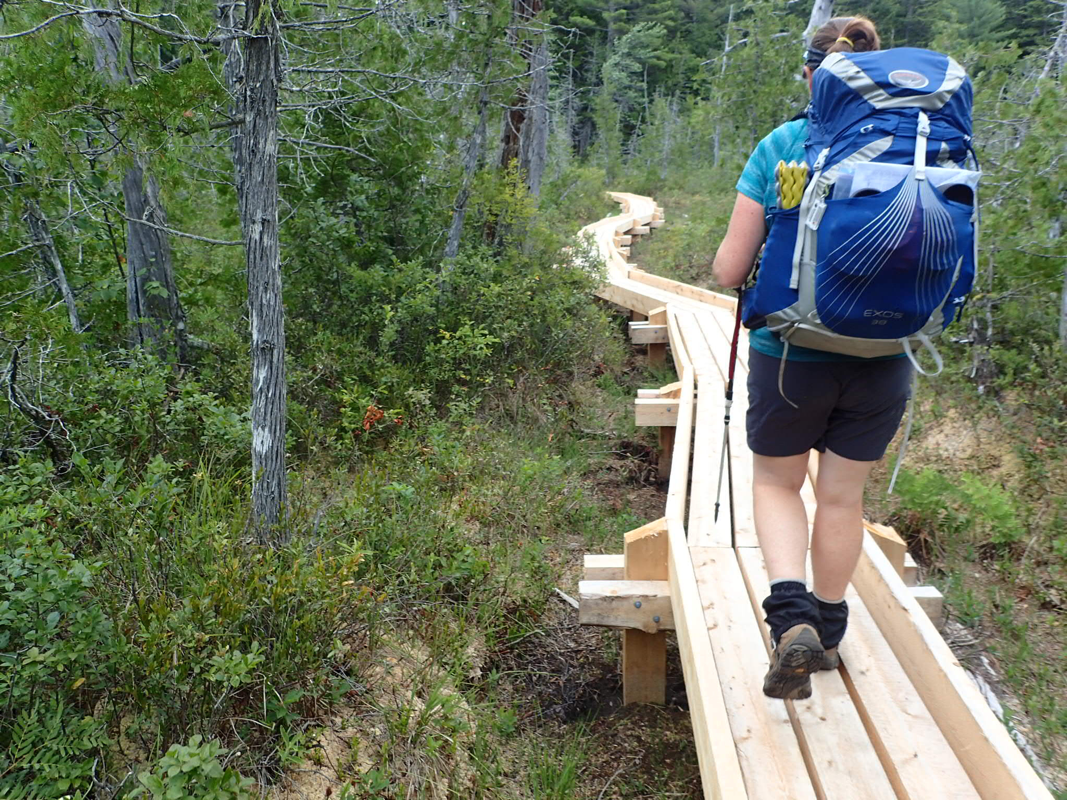
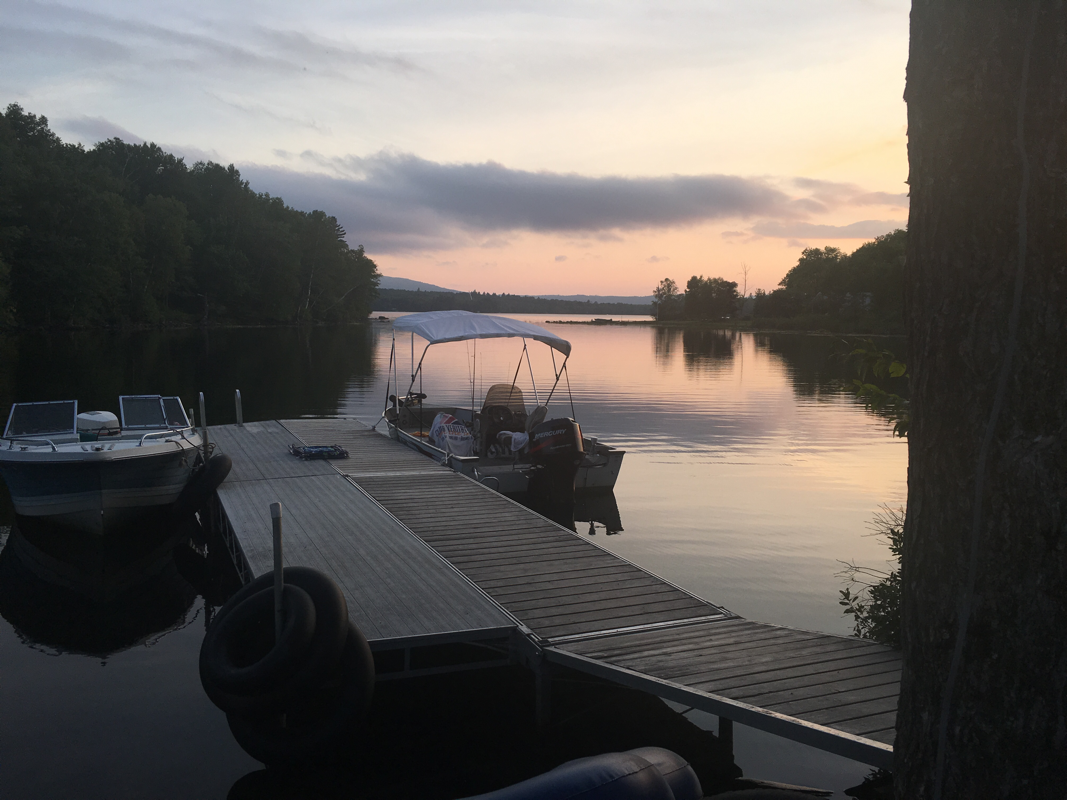
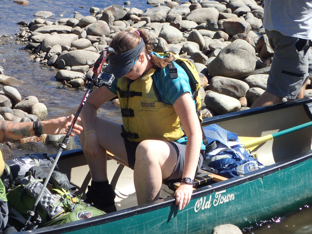
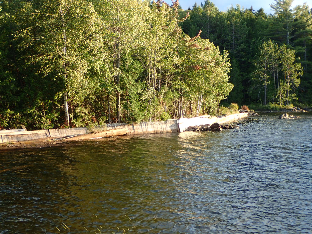
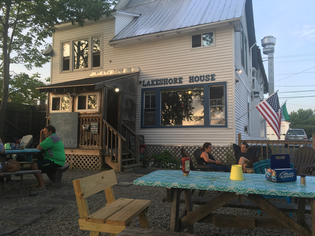
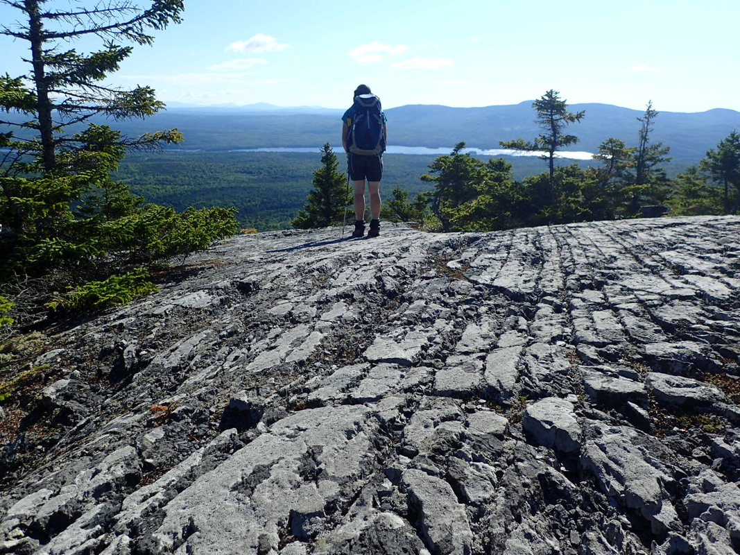
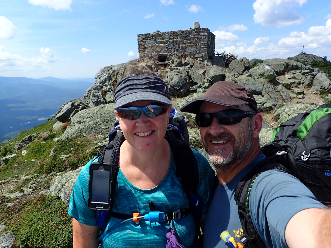
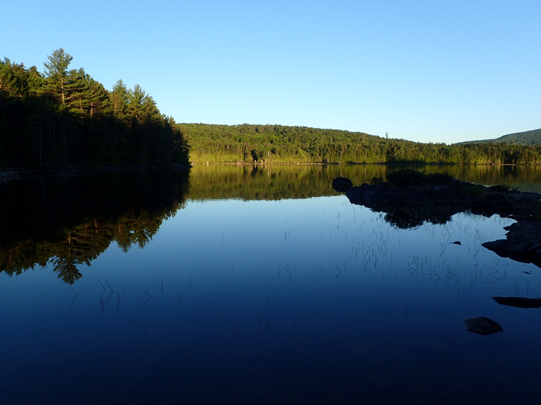
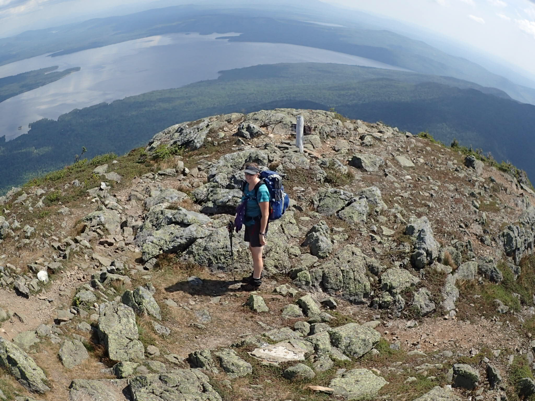
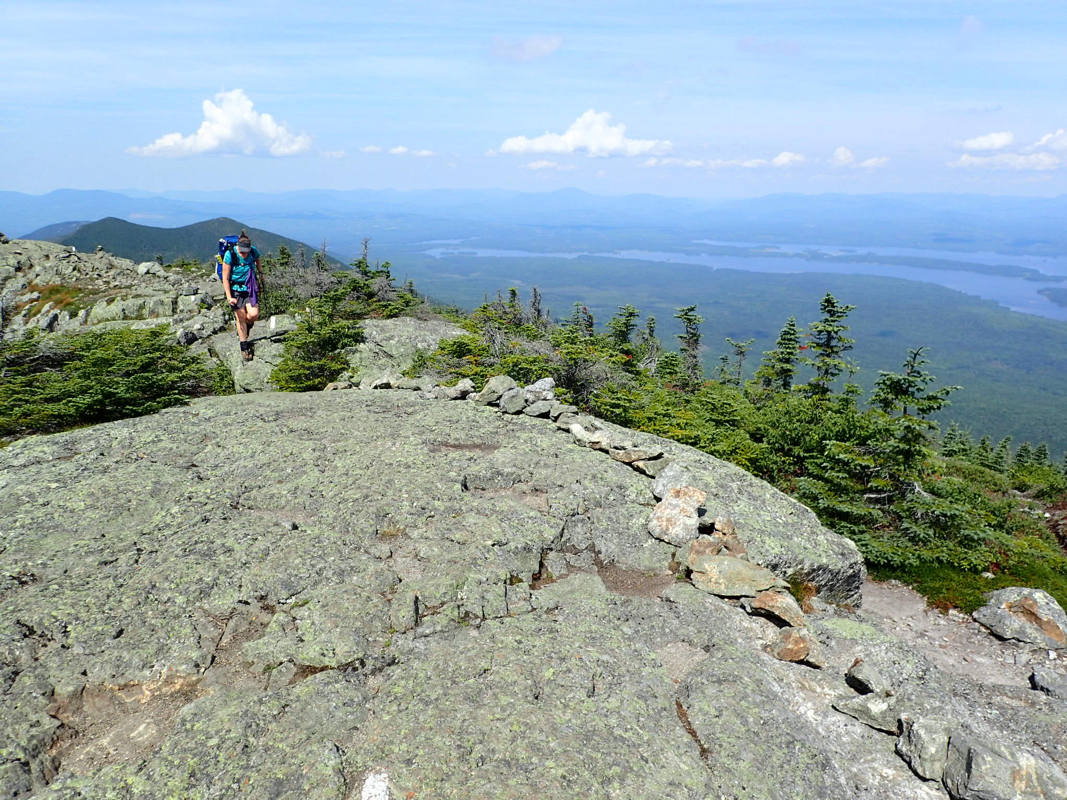
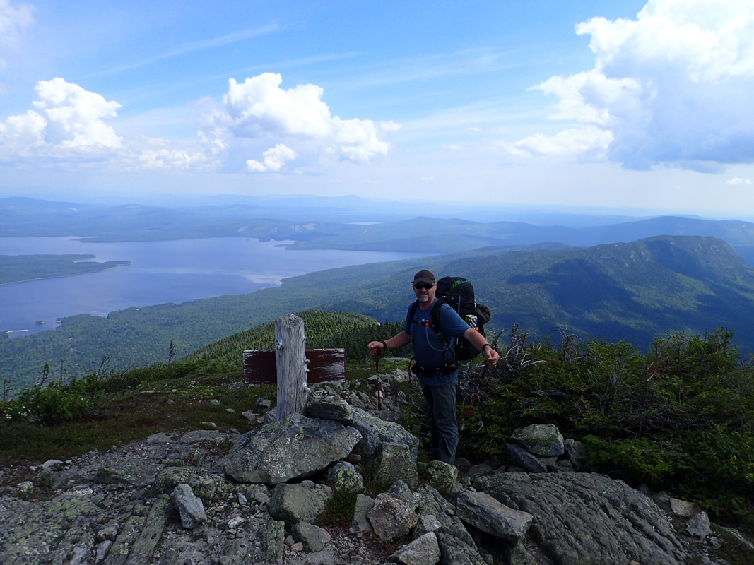
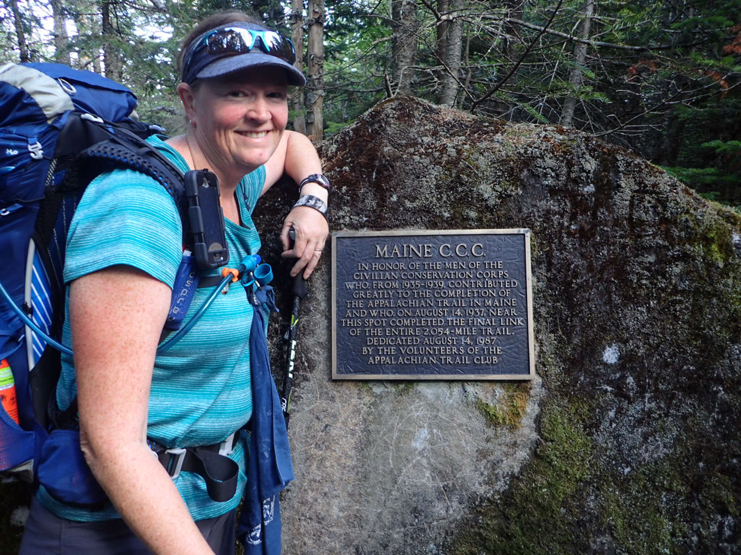
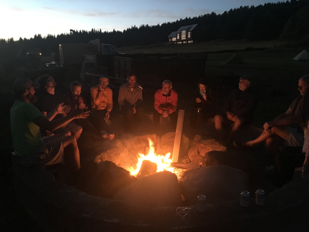
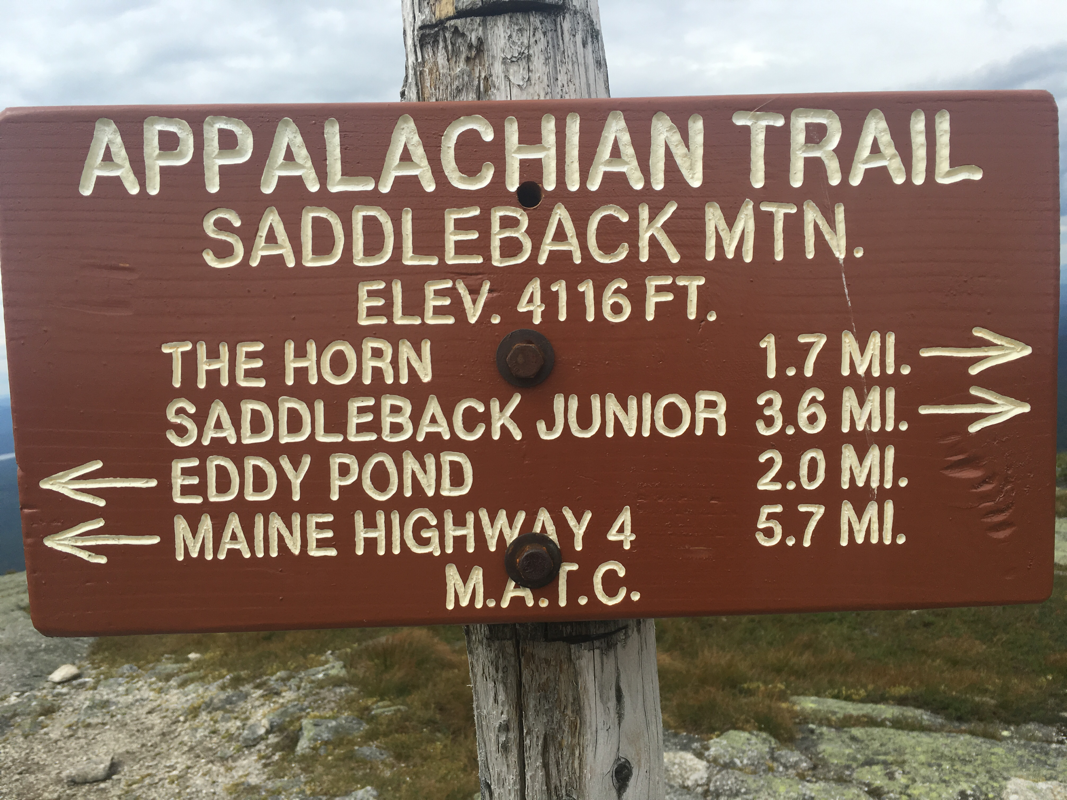
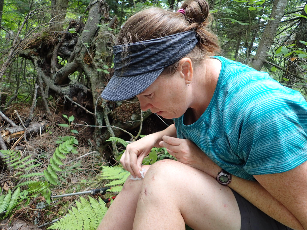
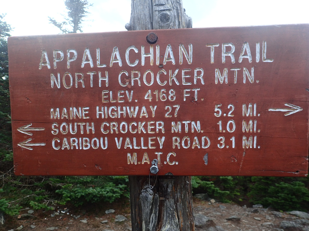
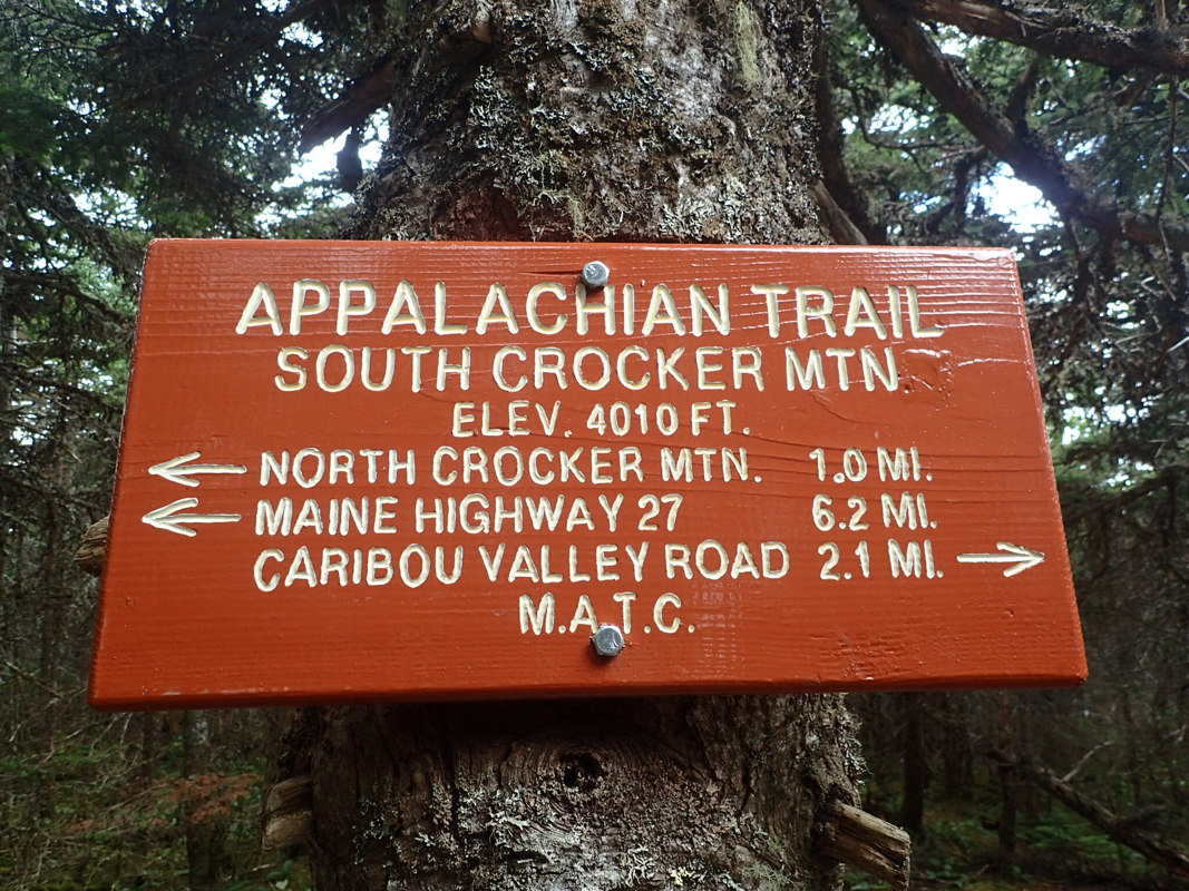
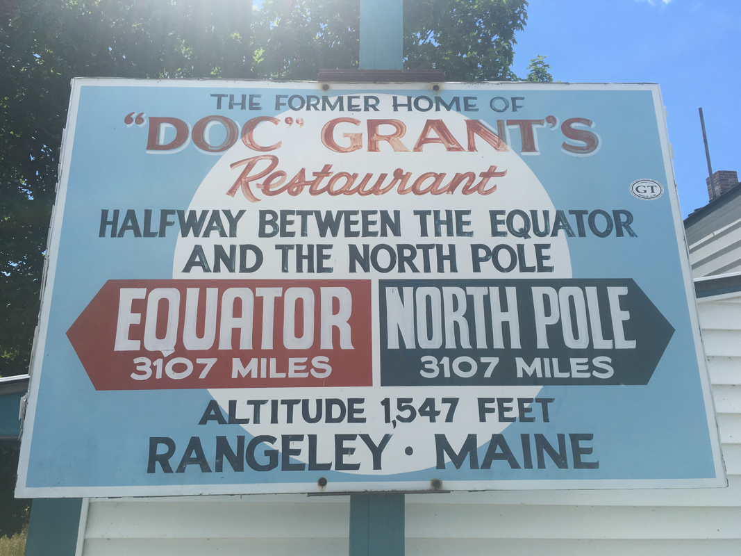
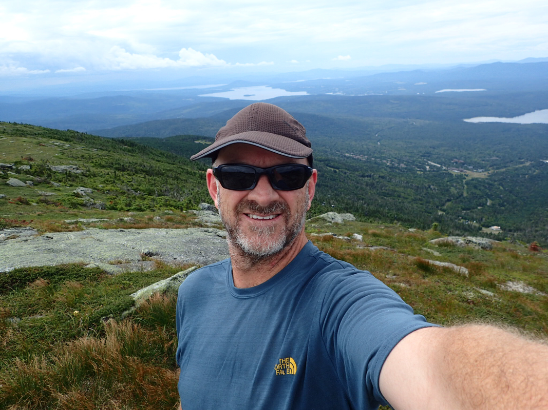
We got a lift from the Shaw's hiker hostel people to the trail head. Shaw's were a great place to stay except for the bed... Who would have thought that to have a good hostel you would need good beds. The bed we had will be familiar to those of you that have ever seen a Western movie where the good guy bursts in to the villains room at the hotel while he's in bed with a busty wench, shoot out = dead villain. It's that bed! The old steel frame number on little castor wheels. It squeaks. I could make it squeak by lying down and just breathing.. Shaw's have lots more beds than just this one so I am sure most other people slept well and were able to hike normally that day. Boo hoo lucky them! So we are now in the 100 mile wilderness. When I think of wilderness I think of someplace in Fiordland. No tracks or roads. In hiking terms it's more like no resupply. The trail has to navigate around several ponds and lakes, so it has some twists and turns. The first few days were like the rest of the trail so far. Hills and mountains. We received our resupply drop at Jo-Mary Road, around 60 miles in. It's a service we paid for provided by Shaw's. It's pretty good, but expensive. We arranged to split the cost with another hiker, Fescue, so it was a little cheaper. The cold soda was a great treat at 9am, so was the warm Budweiser! We then had 4 days food to carry but we had several places to visit along the way this next 40 miles. The great thing was it had stopped raining for the first time in 3 days and we were able to dry out some. When we got in range we texted the owner of a camp called 'Whitehouse Landing'. It's what they call a traditional Maine 'sportsman camp'. We did a bit of a shortish day to stay here. I think 13 or so miles. The 'camp' bit is just what they call a bush get away in these parts. You might have heard of Camp David where Obama has other world leaders for talks. Now they don't sit around a fire pit and retire to a squeaky blowup mattress I can tell you. But Camp Whitehouse Landing was not too bad though. We were picked up by boat after a 15 minute side trail walk. No power or plumbing but it had been around for near on 100 years in one shape or another. The first building on the site was the saw mill owners house, nicknamed the Whitehouse. The mill and land was sold to a paper company around 1910 and last year they felled the trees around the camp. The owners were not too happy to lose a forest of 100 year old trees. I don't blame them. The sunset from our porch was amazing! We stayed with Fescue and Lieut. Dan, so had a nice dinner and drinks with them that night. We also had a pretty good breakfast and then back on the boat for a quite 15 mile day... Our next stop was to be the last 'town' we would stay at. I use the term town loosely though. Abol Bridge was just a camp ground and general store at the base of Mt Katahdin and most AT hikers will stop here for a night or a burger before the big climb. We stayed at the camp ground and shared a bunk room with Fescue. The camp ground water pumps stopped working the next morning. By 7:15 I think everyone in the camp has used the 'bathroom' but still no flush. OMG time to head for the trail I think!! The trails in this part really have reminded us of New Zealand. Largely as we have been following rivers and streams, but also because of the moss. It's a carpet of green over most of the forest floor. We have had to cross a few rivers in these parts too, just like New Zealand! Our friend Fescue crossed a river after us and as is common took off his shoes to cross. As is not common, he threw his shoes to the other bank and wouldn't you know it the one with the socks in hit the only branch on the other side which catapults it into the knee deep river. After a long bare foot chase down the river, it was lost. He found an old boot to use to climb to the top of Mt Katahdin and won't be doing that again... So, it was all leading up to this.. Our final day on the trail. We were pretty nervous for some reason. It had taken a while to get here. We set off at 6:30.. We were up at 5am for like the first time ever! It was a beautiful day! Some clouds and wind but we could see forever. The walk up was not as hard as we were expecting and all the hype we had heard for all those years really was just for the day walkers. Before we knew it, we were looking at the sign 50 metres away. People were everywhere around the sign taking photos and milling around it. We decided to make a bee line for the cairn that marks the summit. Then we were there! One second we were hiking the Appalachian Trail, the next second we were not. We had been dreaming of this moment and we had made it. We both had a few tears up there just sitting and not saying too much. We let it sink in and watched the other hikers that were in the same or similar situations to us. It was a powerful moment for us. We then hugged each other, thanked each other for the totally best holiday one could ever have and made our way to the sign for the photo! This was also a moment I had been worrying about. 7 + months of walking and I had to trust some stranger to take the most important photo of the trip. The start photo at Springer Mountain was taken by some twit that didn't focus properly (it was an old film camera so I guess I can let them off) so I wanted a better photo than the start one. So I told him to keep taking them... Success! At least 1 was good and some are just great! So, it is over! Yes, it's the best trip you can take on your own feet and yes, it can be walked by anyone as long as they are prepared for some pain and discomfort. They also have to be prepared to have the time of their lives and meet some of the best humans living today, AT hikers! Thanks to all our supporters that believed in us and helped us along the way. We owe you! We were so close to Canada we thought it would be silly not to visit. We had the time. We headed to Bangor after we finished the trail and picked up a rental car at the airport. It was just a small airport but all the rental company's had booths. '1 of your cheapest cars please'. Great, they had none so we got an upgrade to the next class for free! I would have been happy if they had given us a car with a V8... Petrol is cheap in the USA and Canada. Although a lot of people now buy what they call compact cars, their is still a lot of big cars and 'trucks' or what we would call utes or pickups on the road. I can tell from the sound of the engine in the pickups that they are petrol not diesel, but at $1.08NZD a liter, who cares!! So, Canada is a strange place. We cross the boarder and all of a sudden everything is in French. All the road signs, advertising and radio. Had we teleported to Europe without knowing? Quebec is a 100% French speaking city, not even bilingual. I remember that the region had a vote to become independent from the rest of Canada and it was a close thing but didn't pass. The revenge was to talk and act like the French. They are doing well but I didn't see one single Citroen or Renault car anywhere so all in all a fail at being French I think. We went to the Bio-dome in Montreal which was the velodrome built for the 1986 Olympic Games held in Canada. Like a lot of games infrastructure it had no real use after the games so they built a really cool bio dome that held the climates of the Americas. It included rain forests and ice environments. Very well done and a great use for the old stadium. It was cool to see the 1500m gold medal winner was the legend John Walker! They had plaques with all the gold medal winners. We won 2 golds then. 1500m and the men's hockey team. I remember that games... 30 years ago now (old eh) The national animal for Canada is the beaver and although we didn't get to pat a live one they did of course have a pelt we could touch and they are amazing. So soft! They have 2 types of fur. A soft under layer and an outer layer that's thicker. They're an amazing animal and we had walked past a lot of ponds created by beavers. They make the dams in the rivers for protection from predators but in the process they provide so much habitat for other animals and wetland birds. Their goal is to make the pond deep and big enough to not freeze in winter. You would think that fish would be on the diet but they eat only plants and of course trees! We saw a lot of evidence of large trees that have been felled by beaver on the trail and once they used to remove the dams but they provide so much to for the forest animals they just leave them now and if necessary re route the trail. We never did see one in the wild though. Next was the largest city in Canada, Toronto. A really nice looking city! Back to English road signs now and English radio stations too. Both Montreal and Toronto are on the Great Lakes. What an amazing thing they are! Having grown up by the ocean, I had trouble getting around the fact it's fresh water. They look like oceans and disappear over the horizon and we even watched massive container ships sail past...still a lake or river. It's a massive country! The number one thing to do in Toronto is visit Niagara Falls. They really as a wonder of the world! I used to go to Huka Falls in Taupo and look in wonder at the volume of water going over them. Well Niagara Falls makes Huka Falls look like a dripping tap. Some fun facts about the falls... -Niagara Falls is comprised of three waterfalls: American Falls, Bridal Veil Falls and Horseshoe Falls. -The American and Bridal Veil Falls were turned off in 1969 by U.S. Army Engineers to study the effects of erosion. -The water that flows over the Falls is at 25-50% capacity at any given time. -The first person to go over the Falls in a barrel was 63-year-old school teacher Annie Edson Taylor. -During periods of peak flow in the summer and fall, more than 2.6 million liters of water per second pour over Niagara Falls. -Four of the five Great Lakes drain into the Niagara River, (Superior, Michigan, Huron and Erie) before emptying into Lake Ontario. These five Great Lakes make up almost 20% of the world's fresh water supply. -Energy from the Niagara River has been harnessed for hydro-electric power generation as far back as the mid-eighteenth century. -Power generation facilities along the Niagara River supply more than one-quarter of all power used in New York State and Ontario. -50 to 75 percent of the water flowing along the Niagara River is diverted from going over the Falls to hydroelectric power generating stations. Niagara Falls was the birthplace of commercial hydro-electric power. In Niagara USA, Nikola Tesla developed the alternating current system, which allowed for the transmission of power generated along the Niagara River to homes and businesses. In 1895 one of the world's first commercial hydropower plants was constructed right on the banks of the river. It's a grand building and is still standing although it stopped producing power in the 70's. I could have watched the falls all day, there quite mesmerising to watch! Back to the USA over the rainbow bridge. Not named for its sexual preference but because the spray from the falls will make a nice rainbow under the right conditions. Wow, what a difference. On the surface Canada appears to be more prosperous than the USA, well in that boarder area for sure. We followed Lake Erie west to the Cleveland area, staying in the city of Mentor. Interstate highway driving all the way. They are great roads! Conceived in 1958 by president Eisenhower they took 35 years to complete to the original vision stage but are of course still being built. Always lots to look at on the side of the interstate and we often pass outlet stores that are more like large malls in the middle of nowhere. In Ohio they had an interesting group of shops along the interstate with a massive sign advertising fireworks, adult products and liquor. Now what could possibility go wrong with that combination?? From Cleveland I made Christine do some driving. I felt like I was punishing her in some way as she wasn't very happy to all of a sudden learn to drive on the right hand side of the road. As it was the freeway she didn't have to deal with oncoming traffic though, but as usual she took it all in her stride and we cruised into downtown Cincinnati without any problems at all. Cincinnati is a really nice city with some very elegant buildings and a brand new riverfront area and it was a nice break to have a walk around for a while even in the 40 degree heat! We stayed just out of the city and the next day it's back on the road again. It didn't take us long, and it didn't feel like it but before we knew it we were back in the south. People started to sound different, the road safety signs for seat belts now read 'buckle up y'all' and we could no longer buy alcohol in the supermarket. Welcome to the 'Bible Belt'. The southern part of America is very different. On our trip in 2000 we spent most of our time in the south and heading back down on this trip it all comes flooding back. Really, America is like a collection of 48 countries. They have different taxes, laws and cultures. Many are similar to each other but the northern states sure are different to the south. It might take some getting used to being here in the south. Today, we headed to a very southern attraction called Dollywood... It's a theme park owned by Dolly Parton, the country music singer. We went to the water park part which is rated as one of the best in the country. The temperature was in the high 90's again today (high 30's in celsius) so it's good to cool off a bit. We didn't meet Dolly but I think I saw her sister. We didn't choose the best day as it was also forecast for thunder and they cleared the pools as soon as the first clap was heard. I don't think anyone has been hit by lighting when swimming but you never know eh..Being at a water park in our togs made us realise how skinny we are now, or rather how large other people are. No one cared though and it made us feel pretty good about ourselves. From here we are going to visit our friends Dave and Sarah. Dave has featured in these blogs before. He is the famous hiker that gave me my trail name, Cowpie! More on that later. We climbed out of the notch with heavy packs after a quick town stop in Stratton. We had 5 days of food and snacks and with our increased calorie intake comes increased pack weight. I spent that evening looking at everything in my food bag to decide what to eat first. It had to be the heavier food of course. The only big hills between us and the finish are now the Bigelows. A range of several 4000 ft high peaks. Stratton had been a great stop for resupplying and we were able to get everything we wanted right there including our favorite stove fuel, but the weight!! How will we manage the 8 day section we have next?? One thing we wouldn't have to deal with is the mud! Right now Maine and a lot of New England is suffering from a drought. This is never a good thing but it means we don't have to wade through waist deep bogs everyday which can't be too bad? For us at this stage of the trail getting water is not too hard. Maine is a state of lakes and ponds so we have water everywhere. We do have a somewhat blocked water filter though. We filter all the water we drink. Out here you fall into one of two camps. To filter or not to filter. We are the filter lot. We have a very simple.filter. Fill a bag with water and it will drain via a filter. It's been great so far but with the ponds we need to let the water settle first. It looks clean but... So we now have a slower filter but still nice clean water! Maine is much like the rest of the Appalachian Trail and it's not too easy to remember highlights of the last few days but something Maine has a lot of is lakes. They call them ponds mostly... not sure why so I looked it up "If the water is deep enough that light does not penetrate to the bottom, and photosynthesis is limited to the top layer, the body of water is considered a lake. A pond is a body of water shallow enough to support rooted plants. Many times plants grow all the way across a shallow pond" OK I think they should be calling some of them lakes...one good thing is they are warm. We have been swimming every day! Our midday swims will usually be fully clothed, you don't know who is around the next corner and we will be completely dry in an hour. If we find ourselves in an out of the way place, it's a full on bath (minus the soap..) and we are then 'hiker clean' ready for the next day or afternoon. Of course we can't stop at every one and we have noticed that it's getting cooler too. Summer won't last for ever So, we are nearing the end of this great trip along the Appalachian Trail. It's been interesting to have a few people ask us why we have come all the way from New Zealand to just do this trip. Well I can remember a time when Christine was still to do her first overnight hiking trip! I can remember getting woken up one Saturday morning by Christine bashing on my door. We were flatting together in a big house with 8 others and I had promised to go walking with her in the morning...but only if I couldn't go fishing, and it was looking pretty good for the fishing really. Anyway it wouldn't be a story if I went fishing would it! That Saturday we went on a short walk, not more than an hour but I remember it well. Towards the end of the walk, we were climbing a slight hill and as we got to the top I could see a giant tree in front of me. A seriously large tree! It was a giant Kauri tree that had been saved from felling more than 100 years ago. OK she had my attention now! We went on several more walks, then overnight hiking trips then the big one. Lake Waikaremoana. 4 day 3 nights. This was going to sort out if she could handle the tough stuff or not. I am pretty sure you can see where we are going with this! The trips just got longer and harder until we are doing the hiking trip to end all hiking trips, the Appalachian trail! Haha I'm sure this will not be the last hiking trip... Tomorrow we will head out on our last 100 miles of this track. They call this bit oddly 'the 100 mile wilderness'. Unlike when we headed out from Stratton, we will have much lighter food bags. The hostel we are staying at will drop us half our food at mile 60 so it's no Foodtown, but it sort of tames the wilderness a bit eh. On the map I am not seeing too much above us either. No towns and only parks. The next 100 miles will send us to the base of the highest peak in Maine, Mt Katahdin in the Baxter State Park. Sadly we will have to do all this without wifi or mobile data because this trail ends in the middle of nowhere. We have stayed at a few hostels or lodges. The best had to be the Green Mountain House because they had the New Zealand flag flying during our stay, but the Pine Ellis Lodge is up there as well. It's almost as if they own a section of the AT and when you are walking on it you are in their home, Well, when we are staying at the lodge we are staying at their home and it's just like they said 'let's have some hikers stay' and threw open the doors. The lodge is in Andover, Maine. The town has a few shops and houses and that's about it. It's claim to fame is the satellite dish station on the edge of town that transmitted the very first live trans-Atlantic video broadcast from the USA. I have no idea why they chose that spot but it could be because it's in the middle of nowhere! I wonder what the broadcast was? Could have been something important like USA presidential election results or maybe something mundane like the moon landing?? If I could be bothered I am sure Google would tell me. When we went to the diner in Andover, we always seemed to meet the same chap. He was very talkative which is a relief because I would have had to answer my own questions otherwise. I learned a lot about him. He used to live on the coast and run some herring boats. His last one ended up in Washington state, right on the other side of the country. He then worked at the satellite station but now teaches people how to drive trucks. He also had a boat with a MerCruiser engine! I think he would see us heading to the diner from his house and follow us as he just sat and chatted, had his favorite ginger beer drink and would leave when we were finished. Still, nice to talk about boating and fishing and stuff. Thanks Stan Morse.. hehe Our first day out of Andover was a slow one. No energy maybe due to the 30+ degree day and the hills. Actually it may not be the hills that are the problem rather the notches. Notches are American for valleys. It seams we just get to the top of a good hill and we have to visit some notch! That first night we stayed at a notch with a hiker we had not met before. His name was Blues Brother. He told us about how he had seen service in the Iraq war. He didn't plan to join the army but 9/11 happened and as every man from every generation of his family going back as far as they can recall had served, he enlisted. He was able to get a special deal and only needed to enlist for 3 years. Just long enough to do his training and a 1 year tour of duty. He got a deal for free university education after he finished his tour and managed to stay alive. All he needs now is a wife that likes hiking... We have started to see a lot more squirrels around the trail. We see two types, red and grey. The ones we are seeing now are the red ones. They're pretty awesome! We think they are quite territorial as when we walk past they can sometimes put on quite a show with chirping and calling and tail wagging until we walk on past. Today I watched one for about 2 minutes. It started with chirping that got more animated and included foot stomping and tail wagging in time with the chirping. Then it did a series of long click/chirps while it stomped it's front legs. All this while looking right at me! It then went back to the chirping and ran around in circles a few times, but the circles were between 3 trees that were 1 metre apart! It was impressive and I wish I caught it on video. That same night at camp we could hear quite a few of them all around us, and again in the morning. They are great thieves and will steal anything edible from around the camp even if we hang it away from the bears, I should say especially if we hang it away from the bears... So we have now been to another town, Rangeley. We went a day earlier than expected because we decided that we were worn out and deserved a day of doing nothing. It really helped that it was parade day here in Rangeley. It's another very small town of similar population to Andover, around 1000 people. The big difference is Rangeley is on some really pretty lakes so has a lot of tourists visit and therefore more shops and services. It's also a centre for the local logging industry. It has a few claims to fame, one being that it's half way between the equator and the North Pole (45 degree parallel) and the other is that the first log skidder was developed here in Rangeley. This year it's going to be famous for the smallest town that the 80's rock band Foreigner played. You know the band that played the hits Cold as ice, Are you old enough, Juke box hero... We were lucky to get accommodation in town at The Farmhouse Inn which is a famous hiker lodge in town. Pretty much everything was booked due to the concert. It was a lot of fun to sit in the back yard of the inn around a large fire pit chatting to other hikers and listening to the band playing some of the music I listened to in my youth. For the last week or two we have been hiking with some really great people. Most of them are hiking sections of the trail, so we can keep up with them!! It's been great to get to know a bunch of people like when we hiked in 2000. The night of the concert we all stayed up too late but had some great fun. We love the southerners! Fat Man Walking, Tractor, Neil and Blues Brother, we mean you. Thanks for the fun! We headed out of Rangeley refreshed and having spoken to Bean, a thru hiker that is a physical therapist for a car racing team, we are taking a bit more high calorie food. The nuts and fruit was not providing enough energy for us and this next section is one of the hardest. As I write this at the top of South Crocker, the 3rd of 4, 4000ft mountains we have to climb today we are glad for her advice. It's grueling stuff. BUT the light at the end of the tunnel is glowing really bright. Today we will officially become 2000 milers and we are now in the 100's of miles to go. We have 1 more mountain range to climb before a section they call 'The 100 mile wilderness'. It's mainly 'flat' and we hope to be able to do 15 mile days or better. Then it's just 1 mountain to climb and we will have finished the entire trail! For now, we head into Stratton to resupply and have some more fun! |
it's Our Epic Trip...David & Christine are from New Zealand and are embarking on a trip around the world the slow way, on foot and by personal vehicle. This could get interesting! Archives
June 2018
Categories
All
|


 RSS Feed
Proudly powered by Weebly